Early access opening soon
Your city in 3D, from one pass with a 360° camera.
OnePass 3D turns footage from an ordinary 360° camera into a measurable 3D street, linked street-level views and your own property records. Inspect places from your browser instead of sending someone back to site.
- Consumer 360° camera
- Runs in the browser
- Links to your records
The problem
Records go out of date faster than anyone can re-survey.
When a team needs to check a building, a street or an asset, someone usually goes to site. Tax, permits, building control and maintenance often repeat the same trip. Specialist mobile mapping works well, but its cost makes frequent updates hard to justify for everyday work.
Missed changes
New construction, extra floors and changed use go unrecorded between major surveys.
Repeated site visits
Different departments send staff to the same street to answer different questions.
Scattered information
Maps, photos and records sit in separate systems that don't point to the same place.
How it works
Capture once. Answer questions from your desk.
-
Drive or walk the route
Record geotagged footage with an off-the-shelf 360° camera. No specialist rig.
-
We reconstruct it
Camera positions and 3D geometry are recovered together, so the model and the panoramas line up.
-
Open it in a browser
Move between 3D and street level, measure what you see and open the record behind each building.
Features
One view of the street, its geometry and its records.
Measurable 3D streets
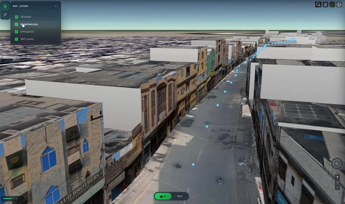
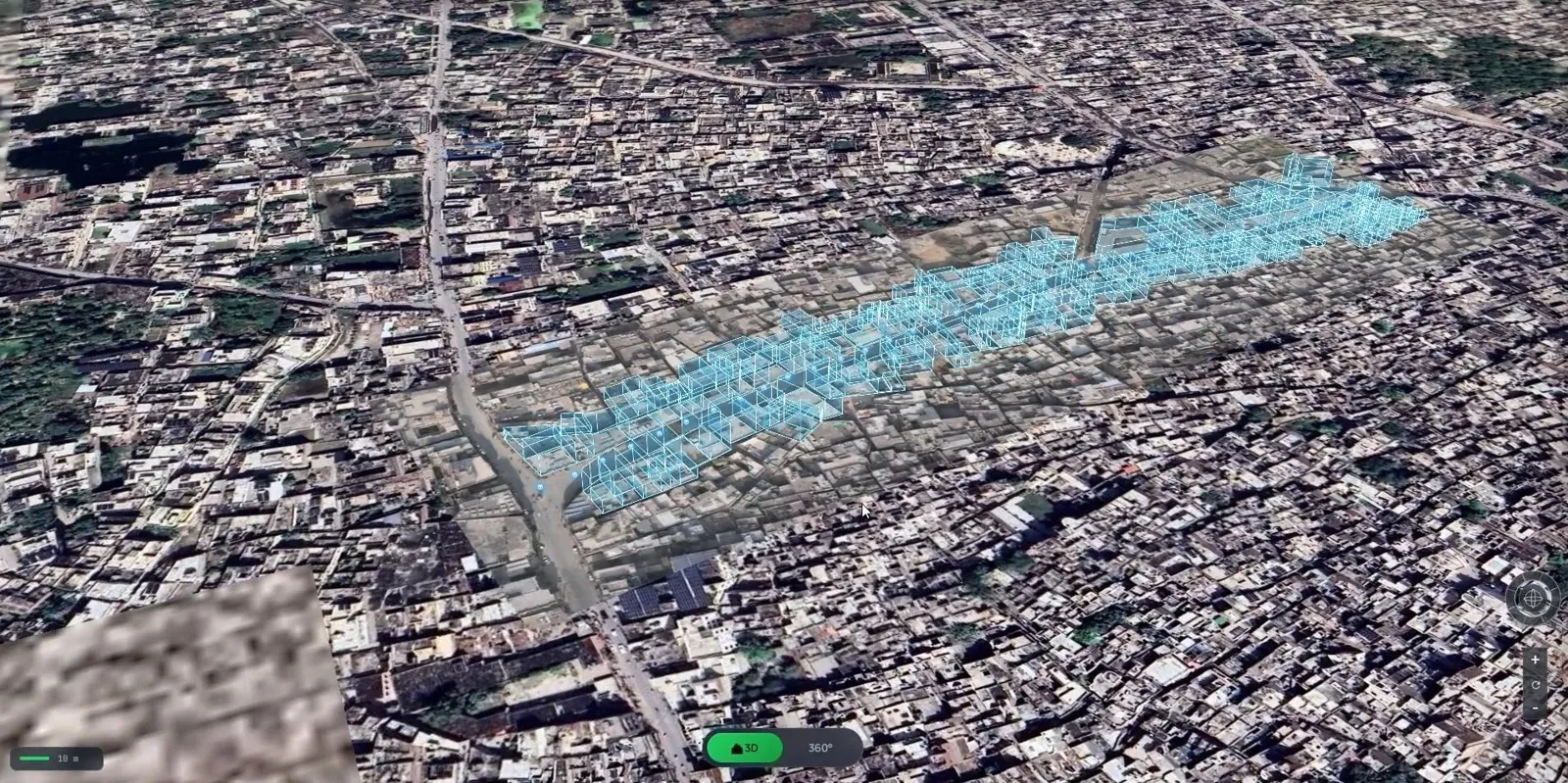
Lightweight 3D geometry of every building along the route, textured from the captured imagery. Measure heights, frontages and road widths directly on the model.
- Toggle the 3D model, textures, orthophoto and 360° points
- Detail streams in as you need it, so it stays fast
Street level, linked to records
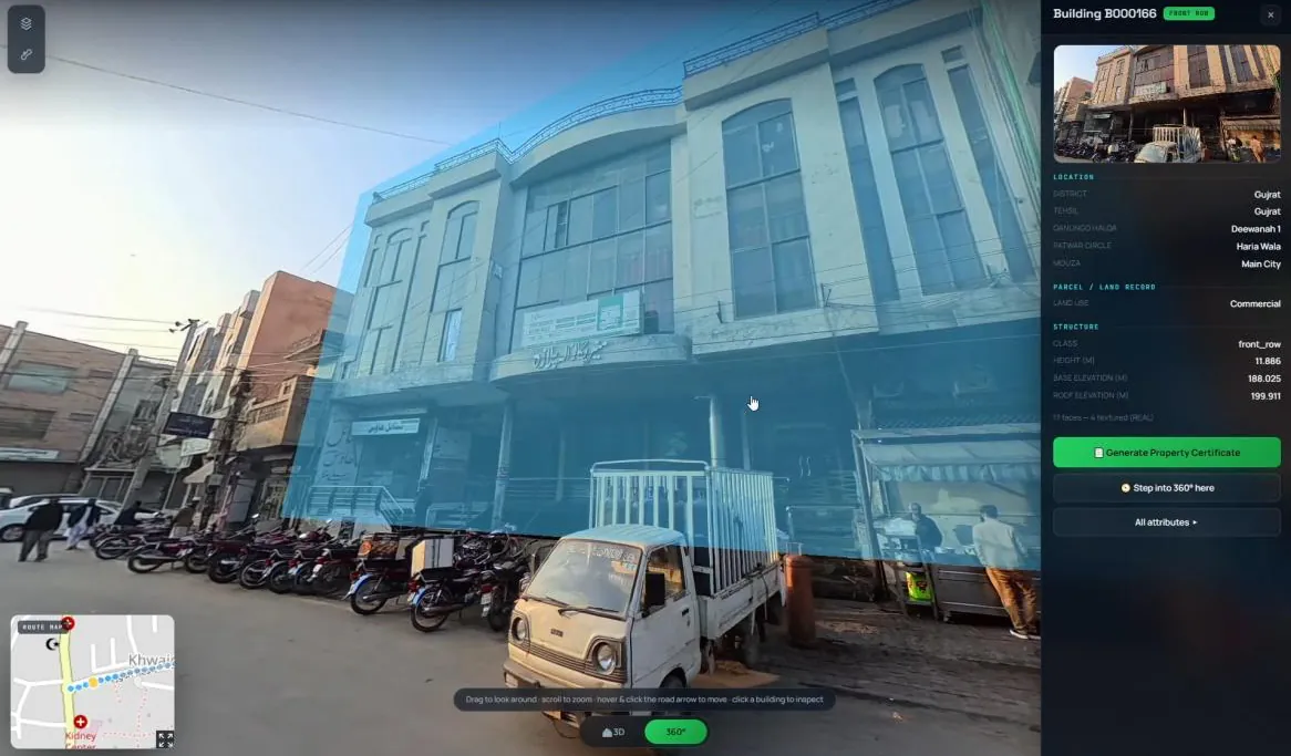
Step into the 360° view on the same spot and click a building to open its record: location, land use and structure details from the data you already hold.
- 3D and panoramas share one spatial foundation
- Connect your own property, land-use or asset records
Ordinary hardware
Capture with a consumer 360° camera instead of a specialist mapping rig.
No installs
Everything opens in a standard web browser, on any office computer.
Repeatable
Low capture cost makes it practical to update an area again and again.
Your data, connected
Bring the records you already keep and see them where they belong.
Demo
See OnePass 3D in action.
The video loads from YouTube when you press play.
Who it's for
Built for teams that manage places.
Check what's actually built
Compare buildings against records, spot unrecorded floors or changed use, and review frontage, access and visible encroachments.
Support property assessment
Give assessors a current visual record of each property so fewer questions need a site visit.
One view of the project
Keep existing conditions, progress and project information in one place your whole team can open.
Deliver more, more often
Capture for your own clients and deliver results in the browser, without a specialist rig.
Inspect remotely
Look at street conditions, signage and assets from the office between maintenance rounds.
Document historic streets
Keep a measurable record of historic places for conservation, research and public access.
From Mapalytics
Built on years of mapping real places.
OnePass 3D comes from Mapalytics, the team behind digital twins, drone surveys and 3D laser scanning for developers, cities and heritage sites in Pakistan and Saudi Arabia.
Questions
Good to know
What camera do I need?
A consumer 360° camera that records geotagged video. We'll share recommended models and capture settings with early-access users.
Is it live?
OnePass shows the street as it was when captured. Its value grows as you repeat capture at a practical interval, such as each assessment cycle.
Does it replace survey-grade LiDAR?
Not for every job. OnePass is designed for everyday operational questions where frequent, affordable updates matter more than survey-grade precision.
Can I use my own records?
Yes. OnePass links captured buildings and assets to the property, land-use or asset data you already hold.
What does it cost?
Pricing isn't final yet. It will depend on the area you manage, how often you update it and the modules you need. Waitlist members hear first.
Early access
Join the OnePass 3D waitlist.
Be first to try OnePass 3D on your own streets. We'll be in touch as early-access places open.
- Early access before public launch
- Pricing news before anyone else
- Product updates, no spam